Wagga Wagga
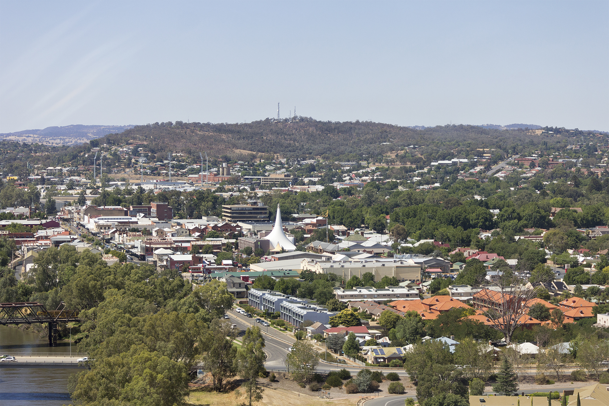 Wagga Wagga (; informally called Wagga) is a major regional city in the Riverina region of New South Wales, Australia. Straddling the Murrumbidgee River, with an urban population of more than 57,003 as of 2021, Wagga Wagga is the state's second largest inland city after Maitland, and is an important agricultural, military, and transport hub of Australia. The ninth largest inland city in Australia, Wagga Wagga is located midway between the two largest cities in Australia—Sydney and Melbourne—and is the major regional centre for the Riverina and South West Slopes regions.
The central business district is focused around the commercial and recreational grid bounded by Best and Tarcutta Streets and the Murrumbidgee River and the Sturt Highway. The main shopping street of Wagga is Baylis Street which becomes Fitzmaurice Street at the northern end. Wagga is accessible from Sydney via the Sturt and Hume Highways, Adelaide via the Sturt Highway and Albury and Melbourne via the Olympic Highway and Hume Highway. Wagga is in an alluvial valley and much of the city has a problem with urban salinity.
The original inhabitants of the Wagga Wagga region were the Wiradjuri people. In 1829, Charles Sturt became the first European explorer to visit the future site of the city. Squatters arrived soon after. The town, positioned on the site of a ford across the Murrumbidgee, was surveyed and gazetted as a village in 1849 and the town grew quickly after. In 1870, the town was gazetted as a municipality.
During the negotiations leading to the federation of the Australian colonies, Wagga Wagga was a contender for the site of the capital for the new nation. During World War I, the town was the starting point for the Kangaroo recruitment march. The Great Depression and the resulting hardship saw Wagga Wagga become the centre of a secession movement for the Riverina region. Wagga Wagga became a garrison town during World War II with the establishment of a military base at Kapooka and Royal Australian Air Force bases at Forest Hill and Uranquinty. After the war, Wagga Wagga was proclaimed as a city in 1946 and new suburbs were developed to the south of the city. In 1982, the city was amalgamated with the neighbouring Kyeamba and Mitchell Shires to form the City of Wagga Wagga local government area. Provided by Wikipedia
-
1
-
2