South Shetland Islands
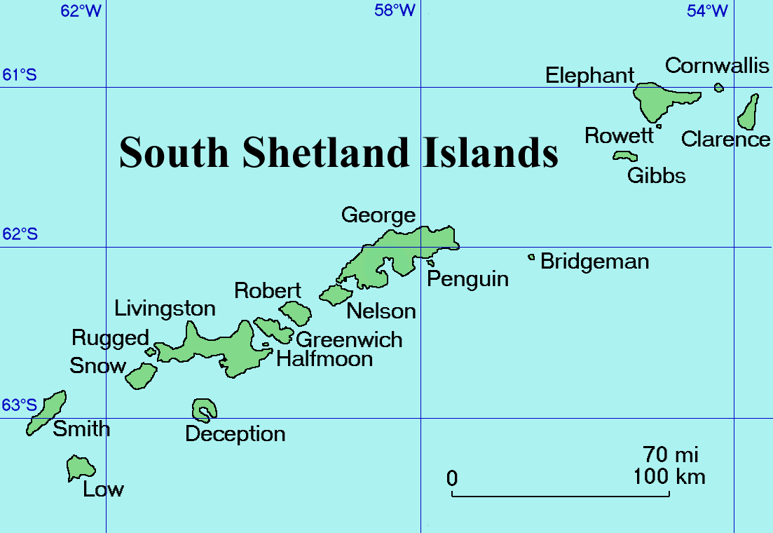 The South Shetland Islands are a group of Antarctic islands with a total area of . They lie about north of the Antarctic Peninsula, and between southwest of the nearest point of the South Orkney Islands. By the Antarctic Treaty of 1959, the islands' sovereignty is neither recognized nor disputed by the signatories and they are free for use by any signatory for non-military purposes.
The islands have been claimed by the United Kingdom since 1908 and as part of the British Antarctic Territory since 1962. They are also claimed by the governments of Chile (since 1940, as part of the Antártica Chilena province), and by Argentina (since 1943, as part of Argentine Antarctica, Tierra del Fuego Province).
Several countries maintain research stations on the islands. Most of them are situated on King George Island, benefitting from the airfield of the Chilean base Eduardo Frei.
Sixteen research stations are in different parts of the islands, with Chilean stations being the greatest in number. Provided by Wikipedia
-
1
-
2
-
3
-
4by Wojciech Kittel, Jacek Siciński, Maria I. Żmijewska, Luiza Bielecka, Katarzyna Błachowiak-samołyk, Zakład Biologii, Polarnej Oceanobiologii, Centrum Biologii Morza, Uniwersytet Łódzki, Polskiej Akademii Nauk, Instytut Oceanografii, Uniwersytet Gdański, Admiralty Bay, King George Isl, South Shetland IslandsGet access
Get access
Text -
5Contributors: “...00c8ef34-4d1b-4e8b-9230-c22ea90be376 Geology of the South Shetland Islands...”
Get access
Get access
Dataset -
6Contributors: “...00c8ef34-4d1b-4e8b-9230-c22ea90be376 Geology of the South Shetland Islands...”
Get access
Get access
Dataset