Lincoln Sea
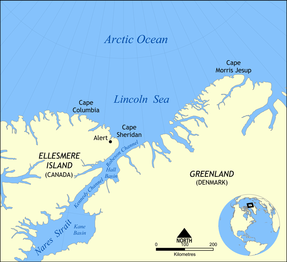 Lincoln Sea (; ) is a body of water in the Arctic Ocean, stretching from Cape Columbia, Canada, in the west to Cape Morris Jesup, Greenland, in the east. The northern limit is defined as the great circle line between those two headlands. It is covered with sea ice throughout the year, the thickest sea ice in the Arctic Ocean, which can be up to thick. Water depths range from to . Water and ice from Lincoln Sea empty into Robeson Channel, the northernmost part of Nares Strait, most of the time.
The sea was named after Robert Todd Lincoln, then United States Secretary of War, on Adolphus W. Greely's 1881–1884 Arctic expedition into Lady Franklin Bay.
Alert, the northernmost station of Canada, is the only populated place on the shore of Lincoln Sea.
The body of water to the east of Lincoln Sea (east of Cape Morris Jesup) is the Wandel Sea. Provided by Wikipedia
-
1