Georges Bank
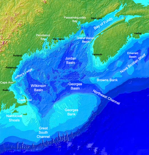 Georges Bank (formerly known as St. Georges Bank) is a large elevated area of the sea floor between Cape Cod, Massachusetts (United States), and Cape Sable Island, Nova Scotia (Canada). It separates the Gulf of Maine from the Atlantic Ocean.
The origin of its name is obscure. The 1610 Velasco map, prepared for King James I of England, used the name "S. Georges Banck", a common practice when the name of the English patron saint, St. George, was sprinkled around the English-colonized world. By the 1850s, it was known simply as Georges Bank. Provided by Wikipedia
-
1
-
2
-
3
-
4
-
5
-
6
-
7by For Major Georges Bank Fisheries, Woods Hole Massachusetts, Anne M. T. Lange, Joan E. PalmerGet access
Published 1985
Get access
Text -
8