Channel Islands National Marine Sanctuary
 The Channel Islands National Marine Sanctuary is a sanctuary off the coast of Santa Barbara and Ventura counties in Southern California 350 miles south of San Francisco and 95 miles north of Los Angeles. It was designated in 1980 by the National Oceanic and Atmospheric Administration.
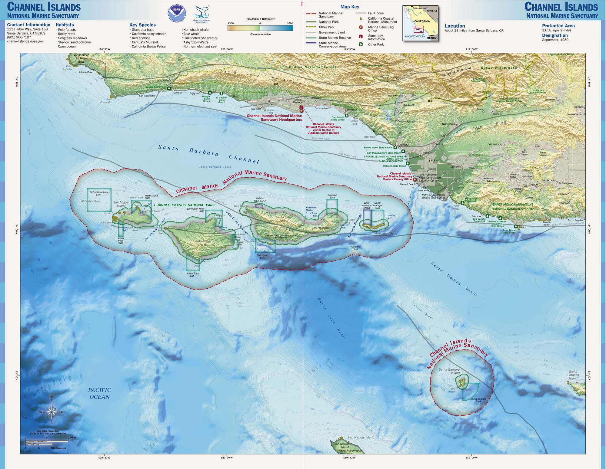
The sanctuary encompasses approximately 1,470 square miles of ocean waters around Anacapa, Santa Cruz, Santa Rosa, San Miguel and Santa Barbara Islands, extending from the mean high tide of these islands to six nautical miles offshore, and surrounding Channel Islands National Park. It is part of the National Marine Sanctuary program under the administration of the National Oceanic and Atmospheric Administration (NOAA).
Its remote, isolated position at the confluence of two major ocean currents supports remarkable biodiversity and productivity. It's a special place for endangered species, sensitive habitats, historic shipwrecks, other maritime heritage artifacts, and living Chumash culture. Many valuable commercial and recreational activities thrive in the sanctuary, such as fishing, shipping, and tourism.
The sanctuary was federally designated because of its national significance as an area of exceptional natural beauty and resources, and due to heightened concerns following the 1969 oil spill in the Santa Barbara Channel. Protection of sanctuary resources is supported through research, education, conservation, and stewardship programs. The primary goal of the sanctuary is the protection of natural and cultural resources contained within its boundaries. The sanctuary is managed to promote ecosystem conservation, protect cultural resources, and support compatible human uses. Provided by Wikipedia
-
1by Goldbogen, Jeremy A., Hazen, Elliott L., Friedlaender, Ari S., Calambokidis, John, DeRuiter, Stacy L., Stimpert, Alison K., Southall, Brandon L.Contributors: “...Channel Islands National Marine Sanctuary...”
Published in Functional Ecology (2015)
Get access
Get access
Get access
Get access
Get access
Article in Journal/Newspaper